
Google Maps has a useful feature that allows you to find out about the air quality in a certain area. You can check your location as well as absolutely any location on the map.
At the same time by selecting the desired location you can read in detail whether the air quality index is elevated or not. You can also determine whether it’s safe to be in that location.
What to do to check air quality in Google Maps using iPhone?
To change the air quality in Google Maps is quite a simple action, all you need to do is to change the map details. To check air quality in Google Maps using iPhone, follow these steps:
- The first step is to open the Google Maps app.
- After that, either enter the address you want or use your current location.
- Then you need to click on the icon in the upper right corner.
- After that, map details will open in front of you, you need to select ‘Air quality’.
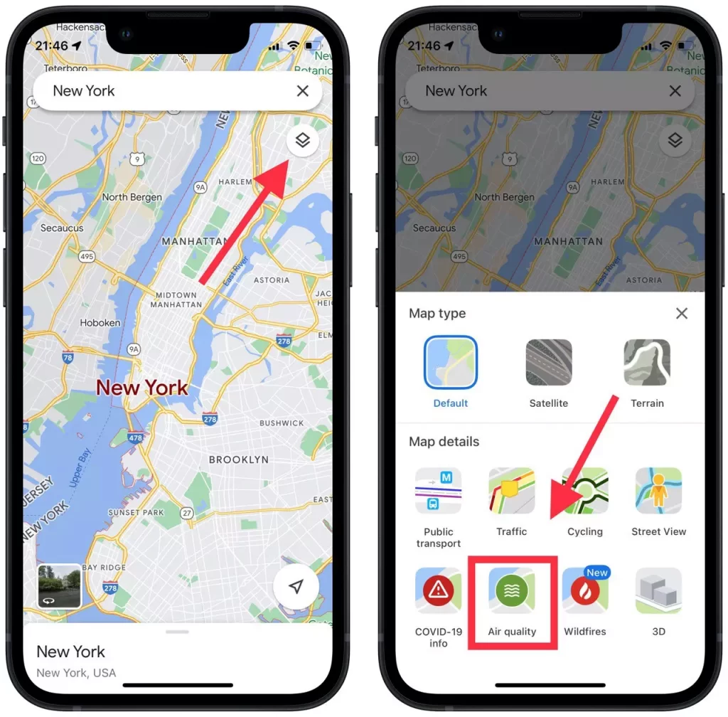
- Then you will be able to open more detailed information about each location with the level of air quality.
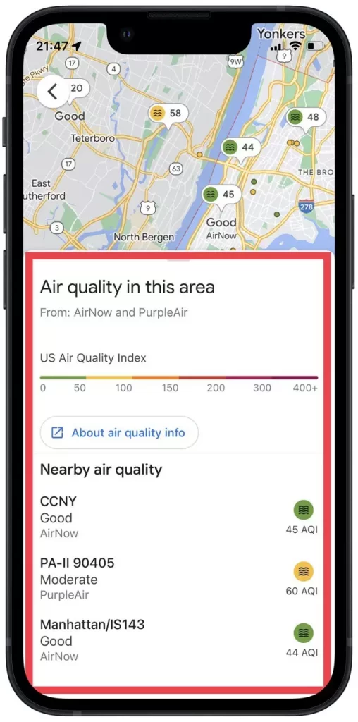
When you enter the air quality view, Google Maps zooms out to show an overview of air quality in a wider geographic area. You must zoom in to get more localized results.
The air quality score and the corresponding color-coded dot for the nearest air quality monitoring stations are displayed as small bubbles. When you click on the tooltip, you will receive additional information, including activity suggestions and the date the information was last updated
Read also:
- How to check traffic to work or home using Google Maps
- How to check how busy the store is right now on Google Maps
- 3D aerial photos of famous landmarks are now available on Google Maps
What to do to check wildfires in Google Maps using a browser?
In case you use Google Maps in your browser, to plan some trip, you can’t check the air quality. This function is available in the mobile version. However, despite this, you can check wildfires in Google Maps using a browser.
Google has launched a new tool to help people stay informed about whether wildfires are threatening them. Along with that, if you have the app installed you will get a notification if you get too close to a fire boundary. To check wildfires in Google Maps using a browser, follow these steps:
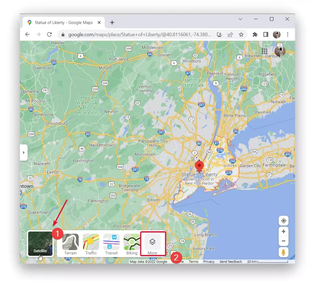
- The first step is to open Google Maps using a browser.
- After that, select the desired location or use your location.
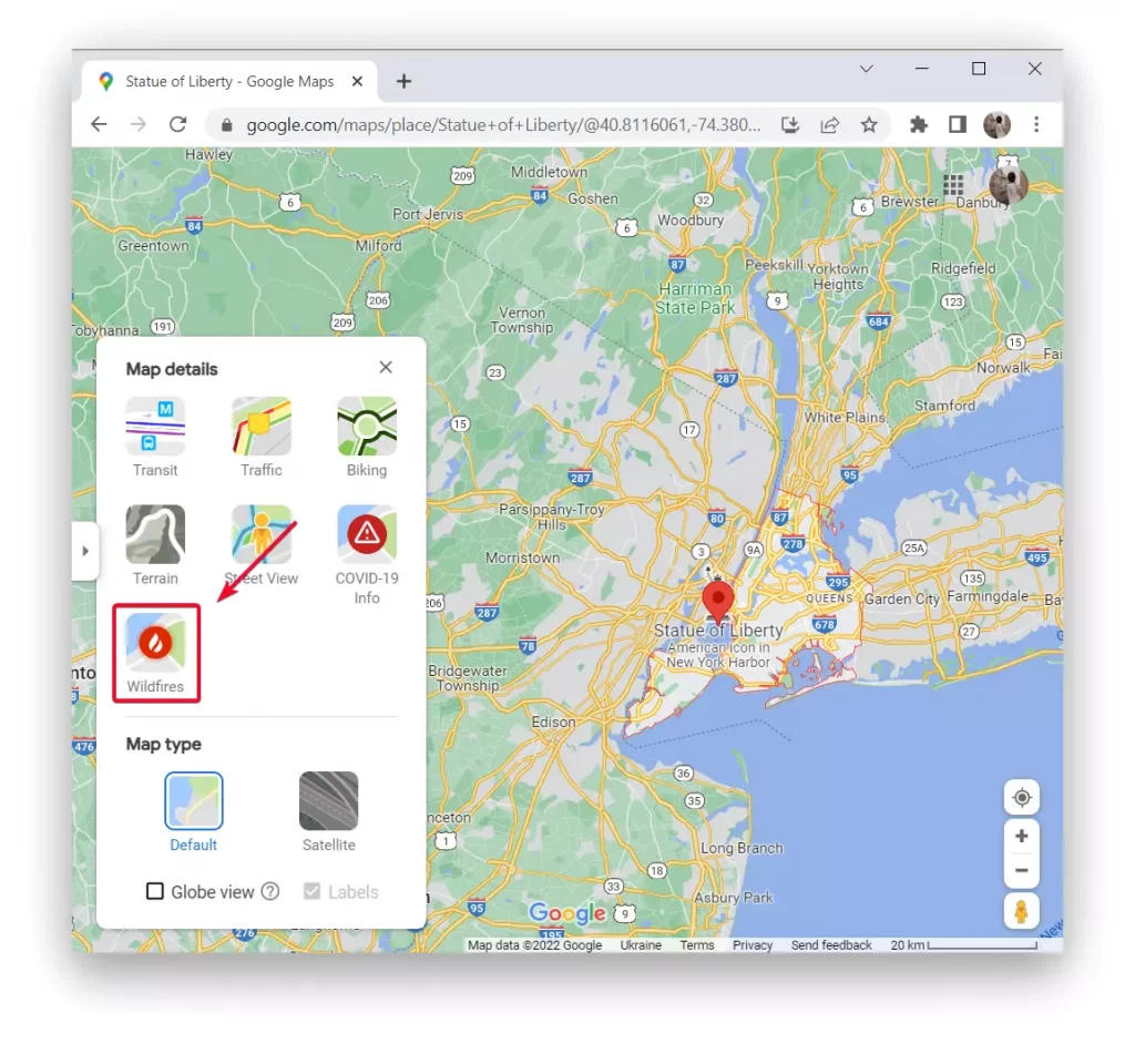
- Then you need to click on the icon in the lower left corner of ‘Layers’ and select ‘More’.
- Next, you need to select ‘Wildfires’ from the list.
At the same time, you can view wildfires in Google Maps also using a smartphone. To do so, follow the same steps. Since the ability to check wildfires in Google Maps is a necessity.
Who provides information about air quality and wildfires?
The air quality index is referred to as the AQI. It’s a measure of how clean or polluted the air is. Google Maps includes data from government monitoring stations as well as unregulated partners to calculate air quality.
It works in a way that calculates a weighted average using the NowCast algorithm. After getting data from other monitoring stations. Google also takes raw sensor measurements and calculates a weighted average using the NowCast algorithm.
Almost all air information data comes from the Environmental Protection Agency and PurpleAir in the United States. Currently, you can check air quality and wildfires in every country, but the data that Google Maps receives may differ from the location.
Google Maps also receives data to track the risk of wildfires. Google uses the analytical tools of the Google Earth Engine. Also monitoring images provided by four National Oceanic and Atmospheric Administration GOES satellites.
These satellites can see huge plumes of smoke and heat spots that indicate areas of fire. This is how Google Maps has access to these technologies with today’s technology.
What should the air quality index be?
The abbreviation AQI is used by all global environmental government agencies to inform the public about the level of air pollution. The Air Quality Index is shown from 0 to 400 on Google Maps.
In most cities, the level of air quality reaches an index of 100. However, you should take into account that the norm is 50. A pollution index of 50 to 100 is already elevated.
The red marking with the highest and most dangerous level of pollution is considered to be above 150. The highest level of pollution in the world is considered to be in Pakistan, Bangladesh, and India.


